Shinyalu Constituency

Shinyalu Constituency is an electoral region in Kakamega County, Kenya, known for its rural farming community and its direct borders with the Kakamega Forest National Reserve. Officially created in 1988 after separating from the larger Ikolomani constituency, it serves as a critical agricultural and political hub in western Kenya.
Shinyalu Constituency

About Shinyalu Constituency

Shinyalu Constituency is an electoral region located in Kakamega County, Kenya. It was created in 1988 after breaking away from the larger Ikolomani constituency. The constituency is a rural area known for farming and its closeness to the famous Kakamega Forest National Reserve.

The Story of Shinyalu Constituency

Established 1988

Formation & Origin

Shinyalu Constituency was officially created in 1988 by splitting the older, much larger Ikolomani Constituency. Before this split, the entire area had been represented under a single parliamentary seat since Kenya’s independence in 1963. The division was made to bring government services and representation closer to the people, leading to Shinyalu’s very first election in 1988, which was won by the late Hon. Japheth Livasia Lijoodi.

The origin of the constituency is deeply tied to the Isukha people, a sub-tribe of the larger Luhya community. This cultural heritage is so strong that five out of the six leadership wards in the area still bear the “Isukha” name today. Historically, the region is also famous for being the heartland of the energetic Isukuti traditional dance, which is globally recognized by UNESCO as an endangered piece of human cultural heritage.

Boundary History

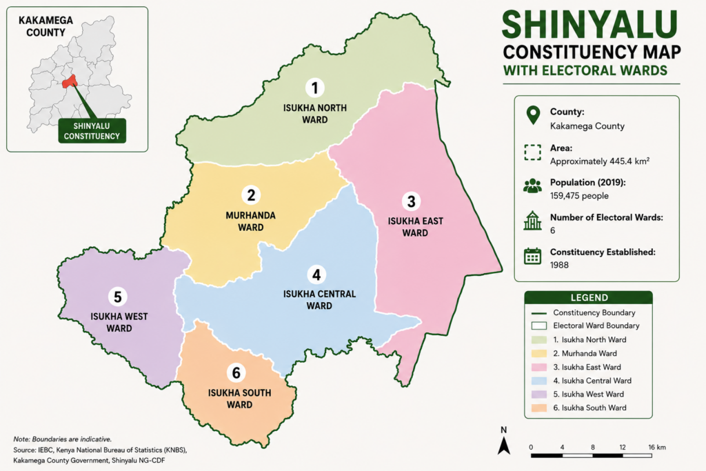
Shinyalu Constituency’s boundaries were officially drawn in 1988 when it was carved out of the larger Ikolomani Constituency. This split was created to make administrative areas smaller and easier to govern, dividing the traditional land of the Isukha sub-tribe into two separate electoral zones.

The constituency’s physical borders are deeply defined by natural geography, specifically the Kakamega Forest National Reserve on its eastern side and the Nandi Escarpment. These natural features create a permanent green barrier that separates Shinyalu from neighbouring areas in Nandi and Uasin Gishu counties, shaping its distinct long and narrow layout.

Over the years, the outer boundaries of Shinyalu have remained remarkably stable. When Kenya completely redrew its national maps ahead of the 2013 elections under the new constitution, the Independent Electoral and Boundaries Commission (IEBC) left Shinyalu’s external lines untouched. Instead, it was converted from a simple voting district into a sub-county under the new Kakamega County government.

Rather than changing on the outside, Shinyalu’s boundary history is about internal splitting. The area was progressively carved into six smaller administrative wards to better distribute local development funds: Isukha North, Isukha South, Isukha Central, Isukha West, Isukha East, and Murhanda.

Name Origin

The name “Shinyalu” comes from a local Luhya language word, “Shinyalu,” which refers to a specific type of indigenous shrub or grass. This plant used to grow in large numbers across the area before it was cleared for farming and homes.

Historically, the location where Shinyalu market stands today was heavily covered by these wild plants. When early colonial administrators and community elders set up a central meeting place and trading post in the area, they simply named the spot after the dominant vegetation they had to clear away.

Historical Significance

Cultural Heart of the Isukuti Dance

Shinyalu is globally famous as the birthplace of the Isukuti traditional dance. This energetic celebration dance features fast drum beats and is officially protected by UNESCO as an important piece of human culture.

Guardian of the Kakamega Forest

Shinyalu serves as the historic, natural gateway to the Kakamega Forest National Reserve. For generations, the local community has lived next to this ancient rainforest, making the area a critical center for environmental research and eco-tourism in Kenya.

Colonial Trading Center

Before independence, the main Shinyalu market was an important administrative meeting point for early colonial chiefs. Elders and colonial rulers gathered here to clear land, set up trade, and manage the wider western region.

Politics in Shinyalu Constituency

Political Profile

Shinyalu Constituency has transitioned through three major political eras:

  • The KANU Era (1988–2002): Following its formation, the constituency was firmly a Kenya African National Union (KANU) stronghold under the leadership of the late Hon. Japheth Lijoodi.
  • The Opposition & CORD/NASA Era (2002–2017): The area shifted decisively toward opposition politics. It overwhelmingly backed the National Rainbow Coalition (NARC) in 2002, followed by the Orange Democratic Movement (ODM) led by Raila Odinga for nearly two decades.
  • The ANC Era (2022–Present): In the 2022 general elections, the constituency shifted its loyalty to the Amani National Congress (ANC), electing the current MP, Hon. Fredrick Ikana Lusuli.

Political Trends

political trends

Key Political Issues

Forest Evictions and Conservation

The proximity to the Kakamega Forest National Reserve makes land rights a permanent political trigger. Past government efforts to evict local populations from forest boundaries or restrict access to forest resources (like firewood and grazing land) always spark heavy political debate during campaign cycles.

Sugar and Tea Sector Infrastructure

As an agricultural zone, the collapse and slow revival of nearby sugar factories (like Mumias Sugar) and the management of local tea collection centers directly affect household income. Politicians are constantly judged on their plans to improve farming roads and secure stable markets for local agricultural produce.

Swing Constituency

Yes, Shinyalu behaves as a localized swing constituency within the broader Western Kenya political landscape. While the voters almost always align with the dominant regional alliance, they regularly switch between specific parties and coalitions. The electorate frequently penalizes sitting MPs, often voting them out after a single term if development expectations are not met.

Elections & Former MPs

A chronological record of parliamentary elections and representatives for Shinyalu Constituency .

Election Representative Party Term Votes Margin Result
2017 Kizito Mugali ODM 2017 - 2022 20,571 4,170 Elected

Economy & Development in Shinyalu Constituency

Economic Profile

Shinyalu…..

Key Economic Activities

Mining, agriculture

Employment & Livelihoods

Employment level is relatively….

Major Economic Assets

Gold mines, Kakamega forest

Development Challenges & Opportunities

Poor infrastructure affects the constituency’s economic …..

Projects & Public Investment in Shinyalu Constituency

Major development projects, public investments and government programmes affecting the constituency.

Major Projects

Major projects….

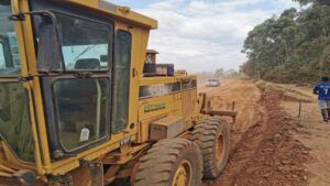
Roads & Transport

Kakamega – shinyalu road

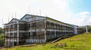
Schools & Education Facilities

Schools

Health Facilities

Hospitals

Government Programmes

Government projects testing

Constituency Development Initiatives

Testing constituency initiatives

Priority Issues in Shinyalu Constituency

The major issues affecting residents and shaping public priorities in the constituency.

🏗️

Infrastructure

Roads are poor

🎓

Education

Schools don’t have resources/facilities

🏥

Healthcare

Hospitals lack medication

💧

Water

Water supply is unreliable

💼

Employment

Unemployment rate is high

🛡️

Security

Security testing…

🌾

Agriculture

Insufficient agricultural…

Understanding Shinyalu Constituency

The constituency’s future will depend heavily on improving road connectivity, expanding access to water and creating opportunities for its growing youth population…

Scroll to Top